– Exploration Sea. – Development of a sea ice area detection system for safe Arctic sea route operations with KIOST research information.
Hello, I’m KIOST from the Korea Institute of Marine Science and Technology.The development of shipbuilding and navigation technology has raised international interest in developing new routes. Among them, Arctic routes in polar waters can reduce the distance of the route by up to 40 percent compared to conventional southern routes passing through the Strait of Muraka and the Suez Canal, and reduce the operating date from 30 days to 20 days. Due to these economic strengths, the volume of distribution through the Arctic Ocean route is steadily increasing.
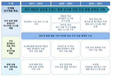
– Necessity of development of sea ice detection system = Recently, sea ice in polar waters has been decreasing rapidly due to global warming, which has the biggest impact on the global environment. However, this is recognized as an opportunity to reduce the cost of operating ships passing through the Arctic Ocean route. Therefore, in order to support the safe operation of ships using the Arctic Ocean route, a method is being developed to detect sea ice areas and find the best route. Up until now, special vessels capable of navigating polar waters like icebreakers have been used to understand the sea ice area, but there was a problem that the amount of information was limited and difficult to detect accurately. This has led to the development of detection systems to better detect sea ice and sea water areas in polar waters.
인기글


.jpg?type=w800 "대구 스마트폰 복구에 있어 파손, 침수, 화재가 되었을때")
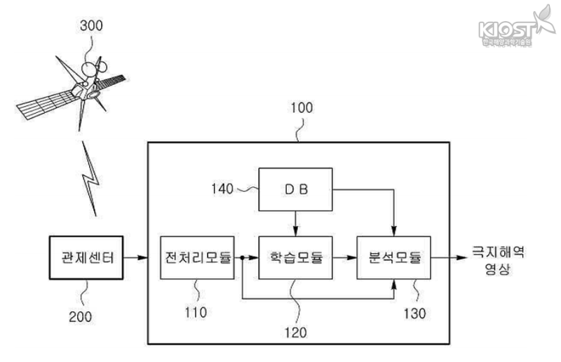
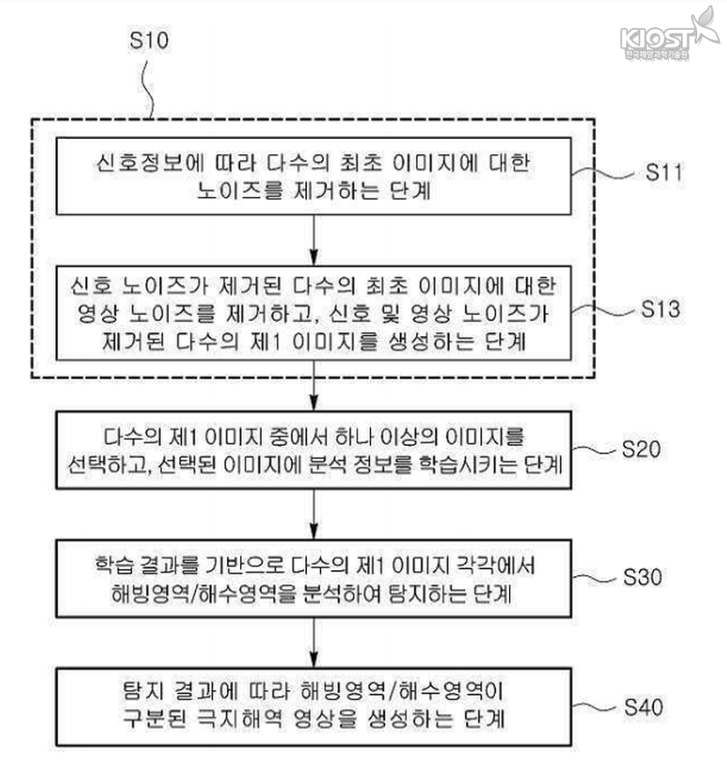
▲ Sea ice area detection method using detection system – sea ice area detection method developed by KIOST is like this. It is provided with a large number of image information, including signal information obtained from synthetic aperture radar (SAR) satellites, and then goes through a preprocessing module that removes noise and makes the image clear. Then, select one or more of the corrected images and proceed with the learning module for learning the analytical information in the pixels of the images. The analysis module then combines the analysis information with the weather information of the already stored polar regions to produce a sea ice detection result image that separates the sea ice area and the sea water area. Based on the images produced in this way, we look for safer routes that are safer Arctic Ocean. KIOST’s sea ice detection system uses a method to improve the accuracy of sea ice detection in polar waters by analyzing polar weather information in addition to images of polar waters generated using satellite observations.
▲ CONFIGURATION OF SEA ICE AREA DETECTION SYSTEM IN POLAR WAT
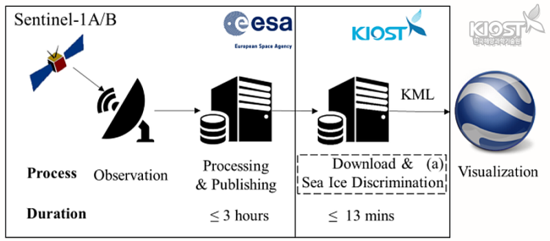
▲ How polar sea ice detection system progresses (Source: Journal of Coastal Research, 2018.05) – The significance of KIOST sea ice detection system development Not only provides the best route for many ships operating the Arctic Ocean route, but also uses satellite observations to detect changes in sea ice.●●●●●●●●●●●●●●●●●●●●●●●●●●●●●●●●●●●●●●●●●●●●●●●●●●●●●●●●●●●●●●●●●●●●●●●●●●●●●●●●●●●●●●●●●●●●●●●●●●●●●●●●●●●●●●●●●● (Detection method and system of sea ice in polar regions) / ●●●●●●●●●●●●●●●●●●● Journal of Coastal Research (2018.05) / ll using Sentinel-1 data●●●●●●●●●●●●●●●●●●●●●●●●●●●●●●●●●●●●●●●●●●●●●●●●●●●●●●●●●●●●●●●●●●●●●●●●●●●●●●●●●●●●●●●●●●●●●●●●●●●●●●●●●●●●●●●●●● (Detection method and system of sea ice in polar regions) / ●●●●●●●●●●●●●●●●●●● Journal of Coastal Research (2018.05) / ll using Sentinel-1 data●●●●●●●●●●●●●●●●●●●●●●●●●●●●●●●●●●●●●●●●●●●●●●●●●●●●●●●●●●●●●●●●●●●●●●●●●●●●●●●●●●●●●●●●●●●●●●●●●●●●●●●●●●●●●●●●●● (Detection method and system of sea ice in polar regions) / ●●●●●●●●●●●●●●●●●●● Journal of Coastal Research (2018.05) / ll using Sentinel-1 data